News
お知らせ
Transform Construction Consulting with Point Cloud Data: Streamline Inspections, Surveys, and Basic Design with Full 3D Site Mapping
A High-Performance LiDAR Plan Designed for Construction Consultants
In the field operations of construction consultants, there are common challenges—such as the lack of as-built drawings during design, missing data due to incomplete field surveys requiring repeated site visits, and the decline in available contractors for surveys and measurements. There is a growing demand for simple, accurate site data collection and efficient data acquisition.
Mapry Co., Ltd. (Headquarters: Tamba City, Hyogo Prefecture; CEO: Keiji Yamaguchi) supports flexible and efficient 3D data acquisition tailored to each project through the optimal use of LiDAR devices.
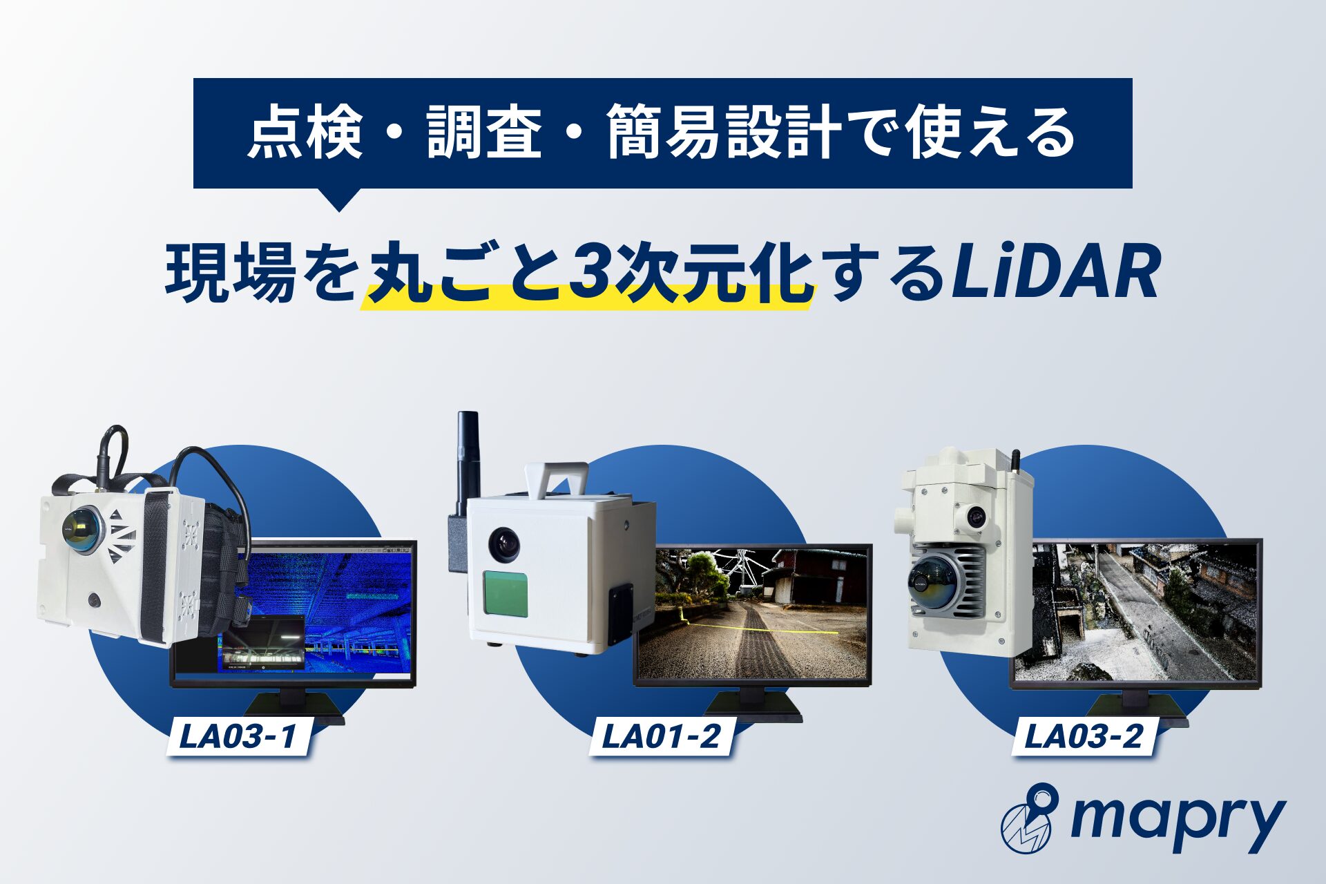
High-Performance LiDAR for 3D Data Collection “Alongside” Site Inspections and Surveys
LA03-1 is a backpack-style LiDAR system that can be worn hands-free. During site visits, meetings with clients, or while conducting inspections, simply walking allows simultaneous recording of point cloud data and video. This device is ideal for tasks such as erosion control, bridge and rockfall inspections, forest road design, and tree surveys. Without adding significant time to traditional workflows, LA03-1 converts entire sites into 3D point clouds, reducing field workload and back-office processing.
Key Features:
Automatically captures video-synced point cloud data while walking
Hands-free design for uninterrupted work
Records vegetation, terrain, and structures with high precision
Automatically analyzes DBH (diameter at breast height), tree count, and height during forest surveys (for rough volume compensation)
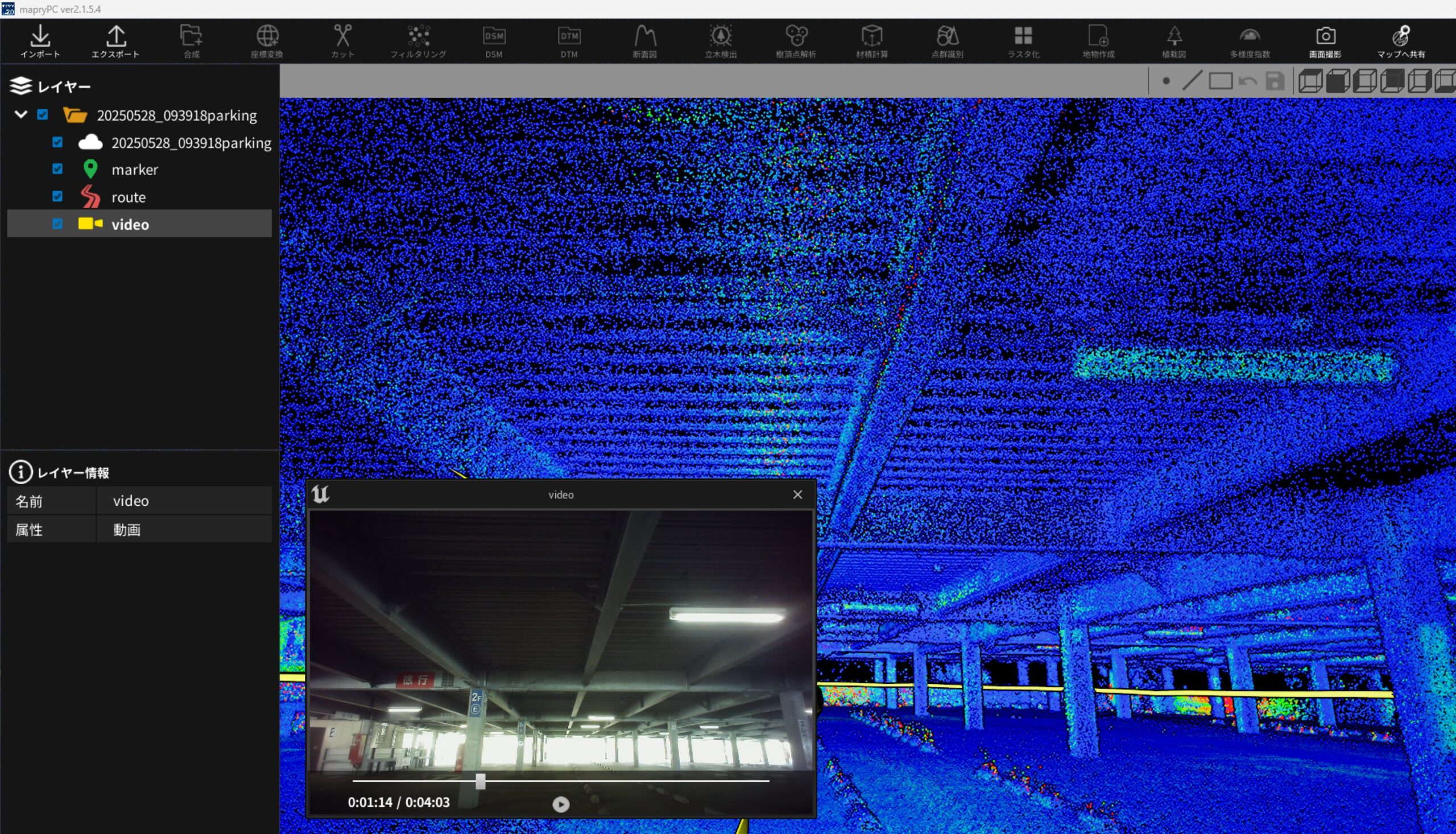
Point cloud and video captured by LA03-1 (clickable for measurements)
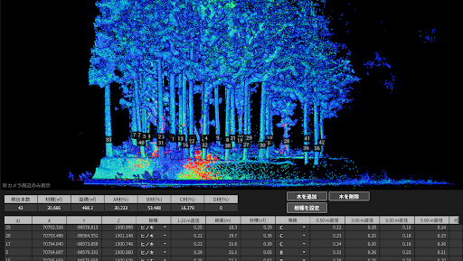
Tree detection and terrain filtering from collected data
High-Precision Data Acquisition
For cases requiring greater accuracy, LA01-2 is ideal. It captures point cloud data with centimeter-level precision using RTK correction. Suitable for tasks like identifying roadside infrastructure, drainage shapes, and road widths for as-built mapping or terrain difference analysis. With a built-in RGB camera, it also records colorized point cloud data.
Key Features:
Color point cloud data capture
RTK-corrected, high-precision 3D data
Adjustable range up to ~200m; suitable for areas where drones cannot fly
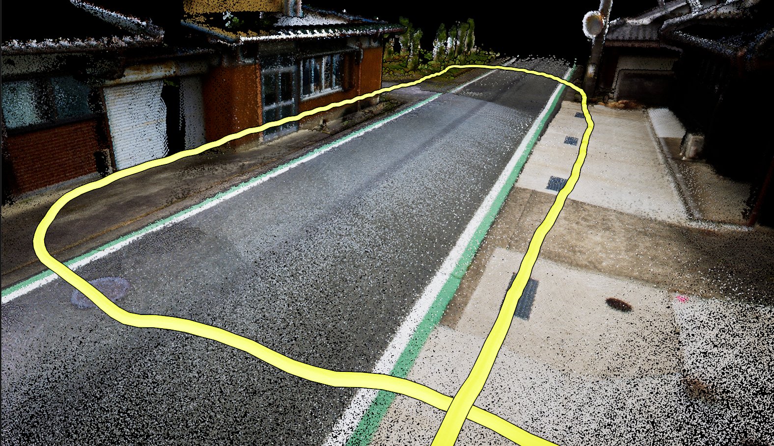
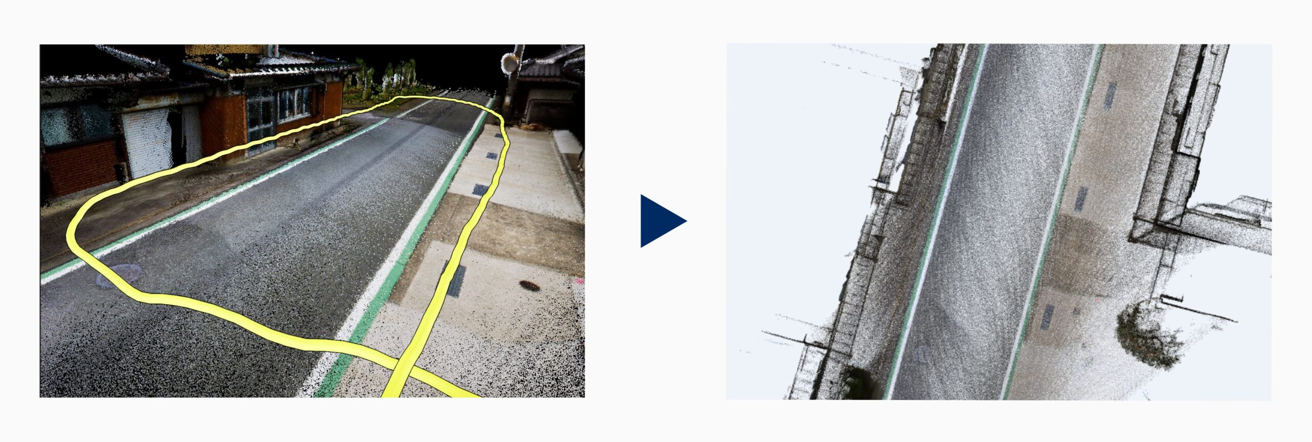
Color point cloud captured by LA01-2 (yellow path shows walking trajectory)
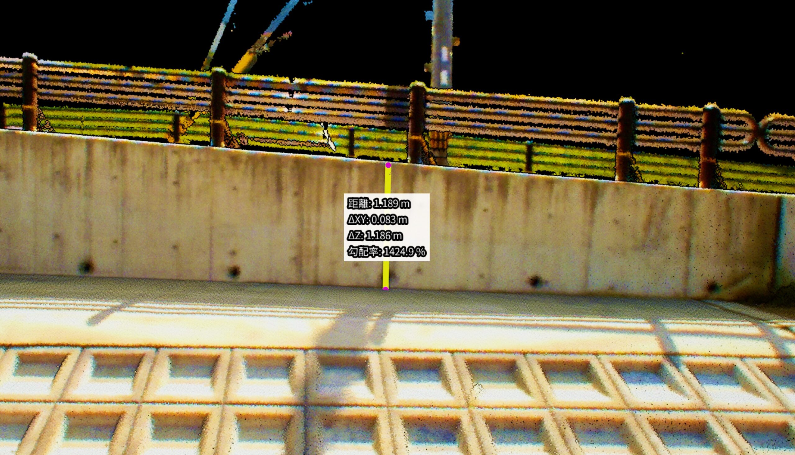
Clearer data when used with a tripod; allows measurement of vertical (ΔZ) and horizontal (ΔXY) distances
Capturing Housing Lots and Urban Sites
For high-density data capture in close-range areas like cities and residential zones, LA03-2 excels. Despite its compact size (~1.3kg, excluding battery), it accurately captures conditions for housing development and exterior design.
Key Features:
Detailed capture in narrow areas like alleyways
Ideal for residential, exterior, and urban site surveys
Useful across various tasks like inspections, photography, and drawing creation
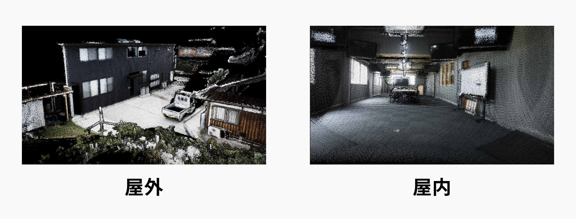
Color point cloud captured by LA03-2
Simple Analysis with mapry PC Software
All point cloud data captured by the devices can be analyzed using the same PC software. Just insert the included USB SSD and click “Load” — even first-time users can easily process the data.
Main Features:
Filtering (thinning/noise removal)
Horizontal and vertical distance measurement, level checks
Coordinate transformation based on control points (3D Helmert transformation)
Terrain filtering (DTM/25cm mesh, etc.)
DXF cross-section generation (2D/3D)
GeoTIFF export for base drawings in CAD
Synchronized video + point cloud playback
LAS format point cloud export
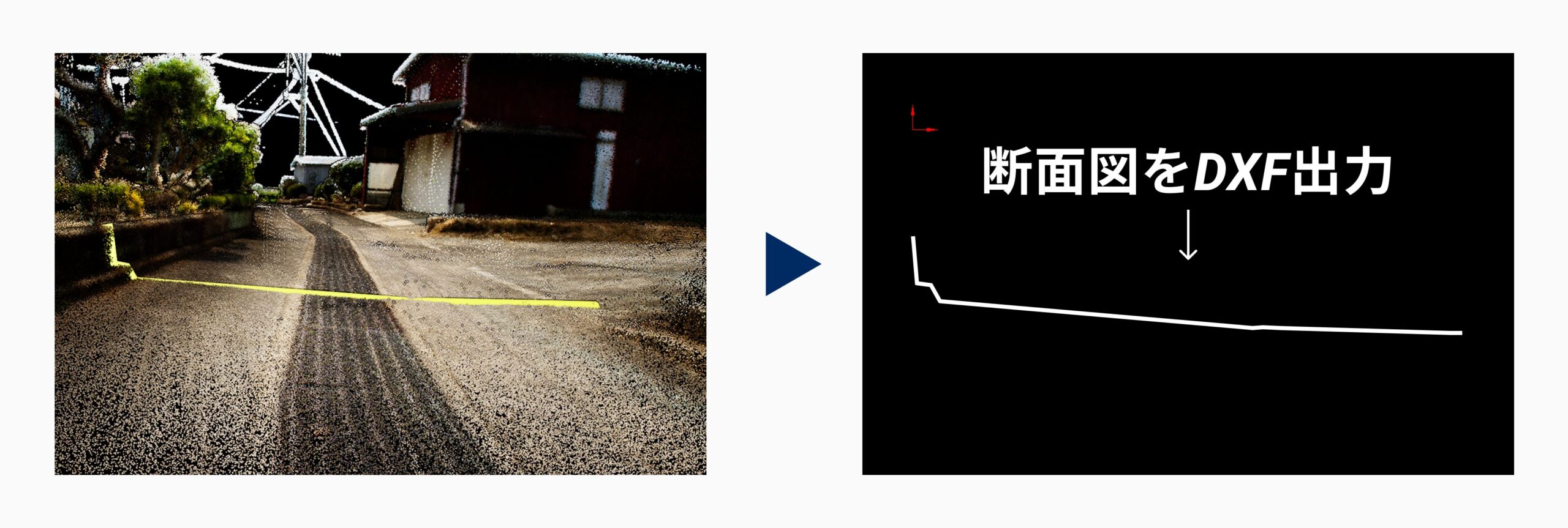
Cross-section diagrams (DXF export)
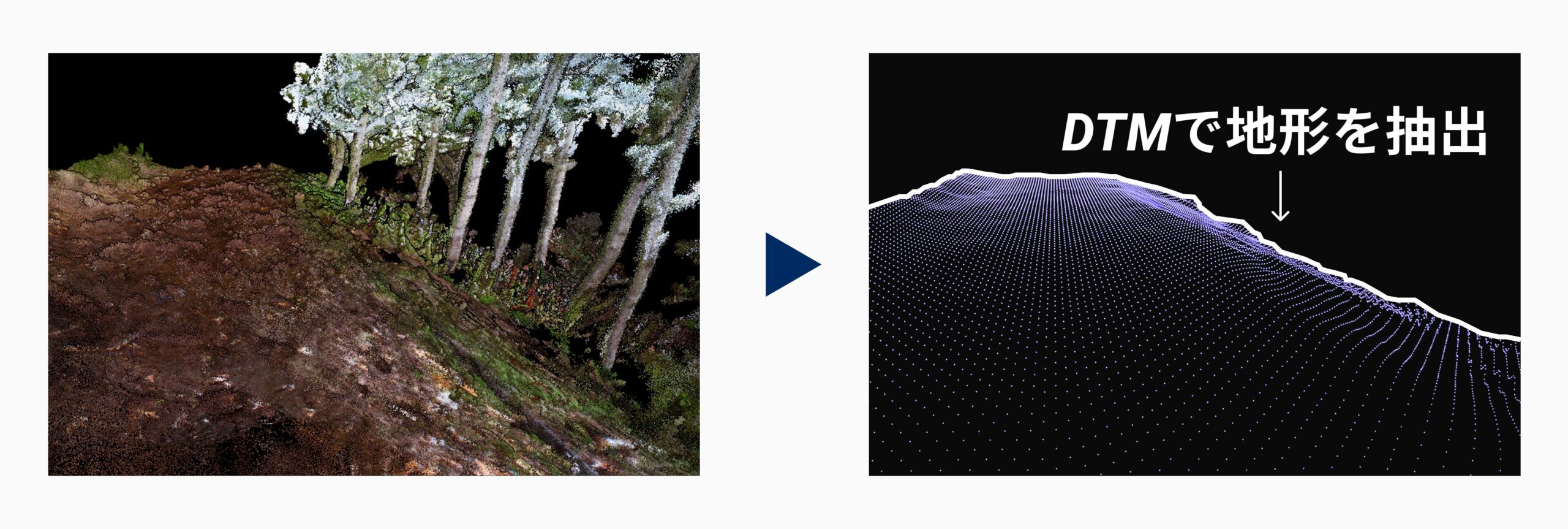
DTM creation via terrain filtering
Overhead raster images for CAD tracing
Before & After – How LiDAR Transforms Field Work
By reducing field workload and shortening post-processing time, LiDAR also improves communication with clients using 3D visuals.
| Traditional Issues | After Introducing LiDAR |
|---|---|
| Remote or steep sites require multiple visits | Accurate site capture via 3D data |
| Two-person, full-day measurement required | One person, minimal time needed |
| Discrepancies between drawings and site conditions | Confirm with synchronized point cloud + video |
| Lengthy coordination with survey contractors | Quick internal verification and survey possible |
Pricing (Excl. Tax)
LA01-2: ¥675,700 (Includes battery & SSD)
LA03-1: ¥295,000 (Includes battery & SSD)
LA03-2: ¥675,700 (Includes battery & SSD)
R1 GNSS Receiver: ¥95,000
mapry Surveying Software: ¥10,000/month
Control Devices (iPhone or Android): Sold separately
Ntrip Service Fee: Sold separately
Maintenance Service: Optional (includes damage insurance during use)
Note: LA01-2, LA03-1, and LA03-2 require an Android device. iPhone use requires iPhone 14 Pro or newer models.
Each device has unique strengths, but combining LA03-1 and LA01-2 allows for versatile use across different sites. For instance, LA03-1 for inspections or walkthroughs, and LA01-2 for high-precision surveying.
Post-Purchase Support
We offer tailored usage support for each device and application—via online or email.
For more product details or inquiries:
About Mapry
Mapry offers solutions for professionals in surveying, forestry, disaster prevention, agriculture, and construction. We make 3D data acquisition, analysis, and utilization more accessible, especially for those who have struggled with high equipment costs or complex operations.
Company Overview
Name: Mapry Co., Ltd.
Headquarters: 165 Tada, Kasuga-cho, Tamba City, Hyogo, Japan
CEO: Keiji Yamaguchi
Website: https://mapry.co.jp/
Inquiries: info@mapry.co.jp