News
お知らせ
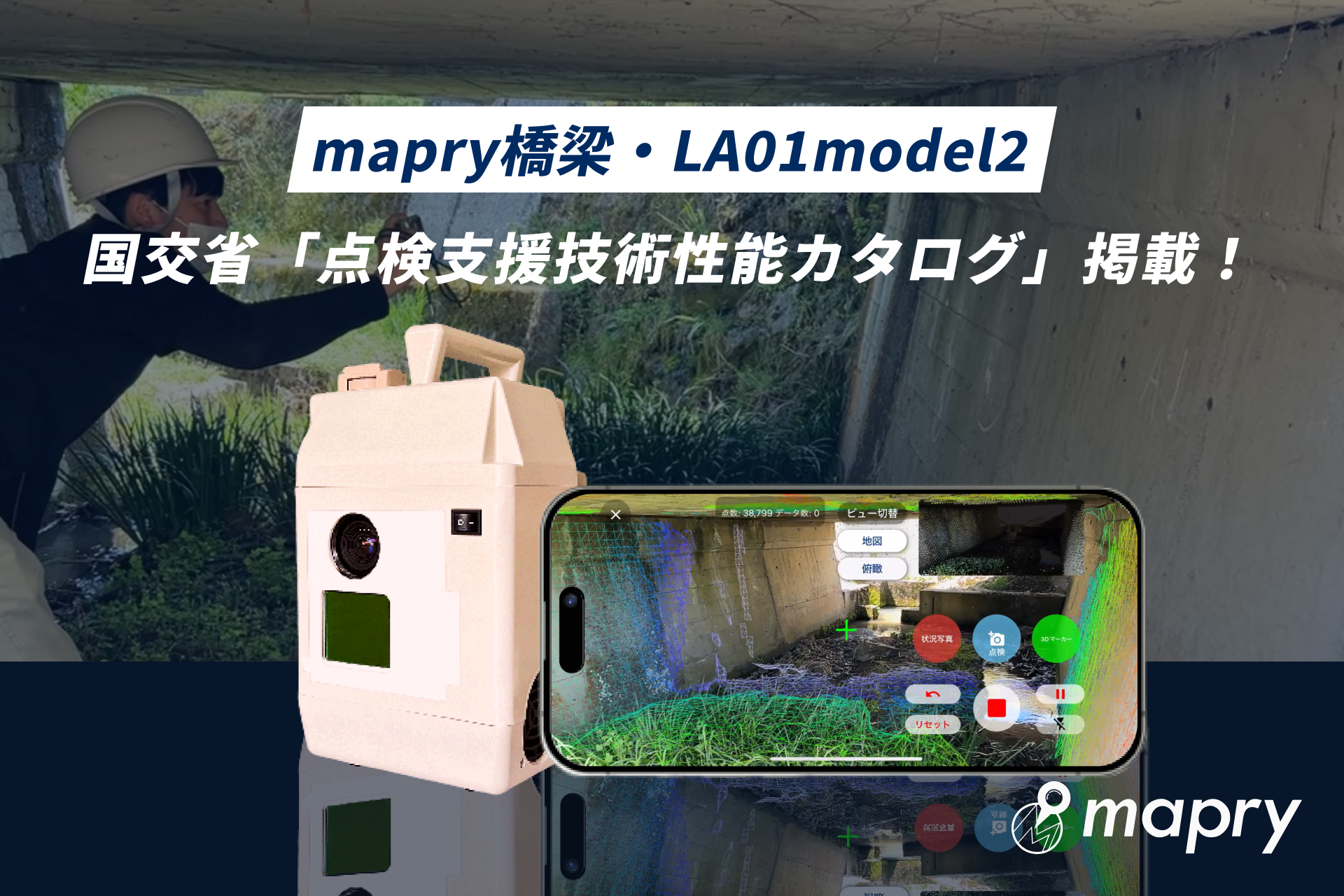
mapry Products Featured in MLIT’s “Inspection Support Technology Performance Catalog (Bridges)”
Mapry Co., Ltd. (Head Office: Tamba City, Hyogo Prefecture; CEO: Keiji Yamaguchi; hereinafter “Mapry”), provider of the geospatial information app platform service “mapry,” is pleased to announce that its bridge inspection application “mapry Bridge” and LiDAR measurement device “LA01-2” have been included in two categories of the “Inspection Support Technology Performance Catalog (Bridges)” published by the Ministry of Land, Infrastructure, Transport and Tourism (MLIT) of Japan.
Included Categories:
・Image Measurement Technology (Technology No.: BR010084-V0025)
・Measurement & Monitoring Technology (Technology No.: BR030068-V0025)
As a result, these technologies are now recognized as new solutions that can be utilized in bridge inspection tasks conducted by local governments.
About the “Inspection Support Technology Performance Catalog (Bridges)”
This catalog, published by MLIT, compiles new technologies that can be applied to bridge inspections. It clearly outlines the effectiveness, accuracy, and applicable scope of each technology as an alternative or complement to close visual inspection, helping road administrators and engineers select appropriate tools for their needs.
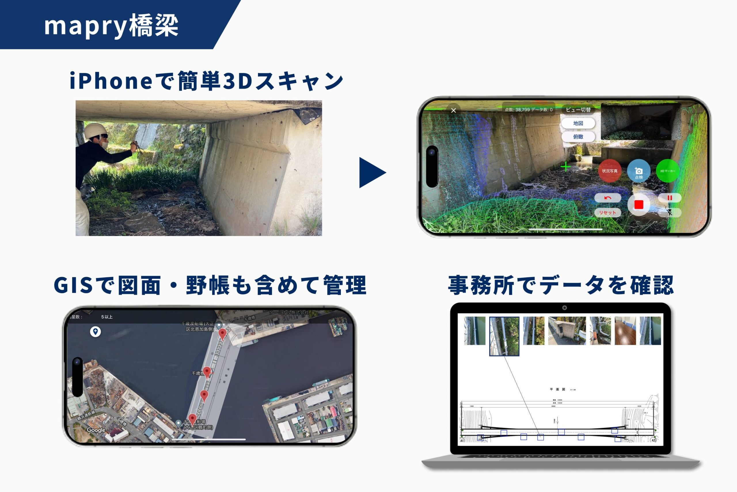
About “mapry Bridge”
“mapry Bridge” is an iPhone application that utilizes LiDAR functionality to inspect bridges by combining 3D point cloud data and photographs. It allows users to import past damage records and field notes, linking them with newly collected data on-site. This integration streamlines everything from field inspections to office-based photo management, improving both the efficiency and accuracy of inspection operations.
[Click here for details.]
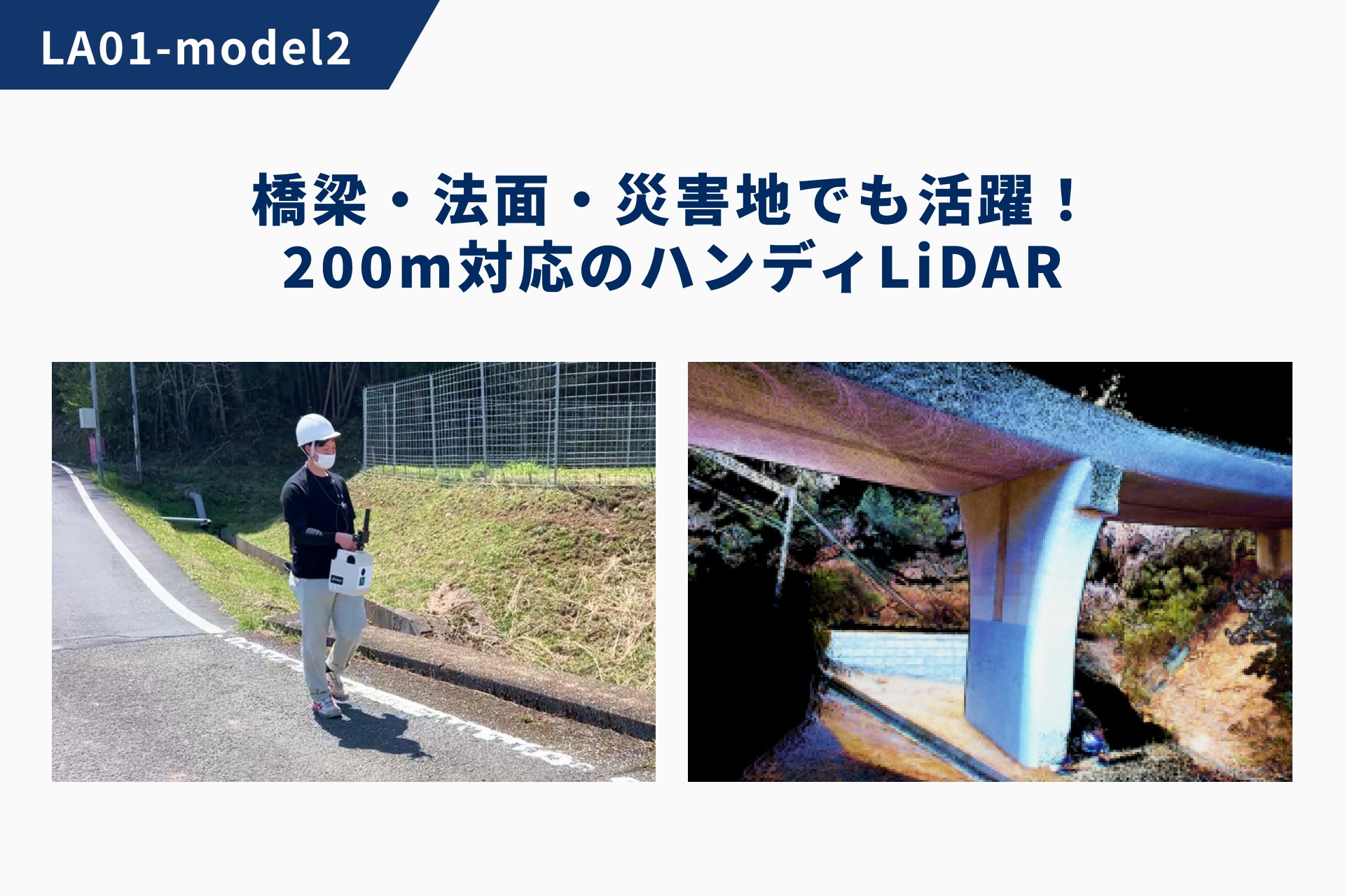
About “LA01-2”
The “mapry LA01-2” is a handheld LiDAR measurement device that captures colored point cloud data while walking. It enables smooth scanning even in complex environments and can measure objects up to 200 meters away in full color 3D. It’s suitable for a wide range of applications including residential areas, roads, bridges, slopes, and disaster sites. Despite being equipped with a high-precision GNSS for accurate positioning, it is priced affordably at around 800,000 yen, offering high-quality data acquisition at a low cost.
[Click here for details.]
Product/Service Inquiries
https://mapry.co.jp/contact/
About Mapry Co., Ltd.
Mapry provides services for professionals in surveying, forestry, disaster prevention, agriculture, and construction. The company offers solutions that make it easier to acquire, analyze, and utilize 3D data—once considered costly and complex—by lowering the barriers associated with equipment cost, operation, and data processing.
Company Information
Company Name: Mapry Co., Ltd.
Head Office: 165 Tada, Kasuga-cho, Tamba City, Hyogo Prefecture
CEO: Keiji Yamaguchi
Website: https://mapry.co.jp/
Inquiries: info@mapry.co.jp