News
お知らせ
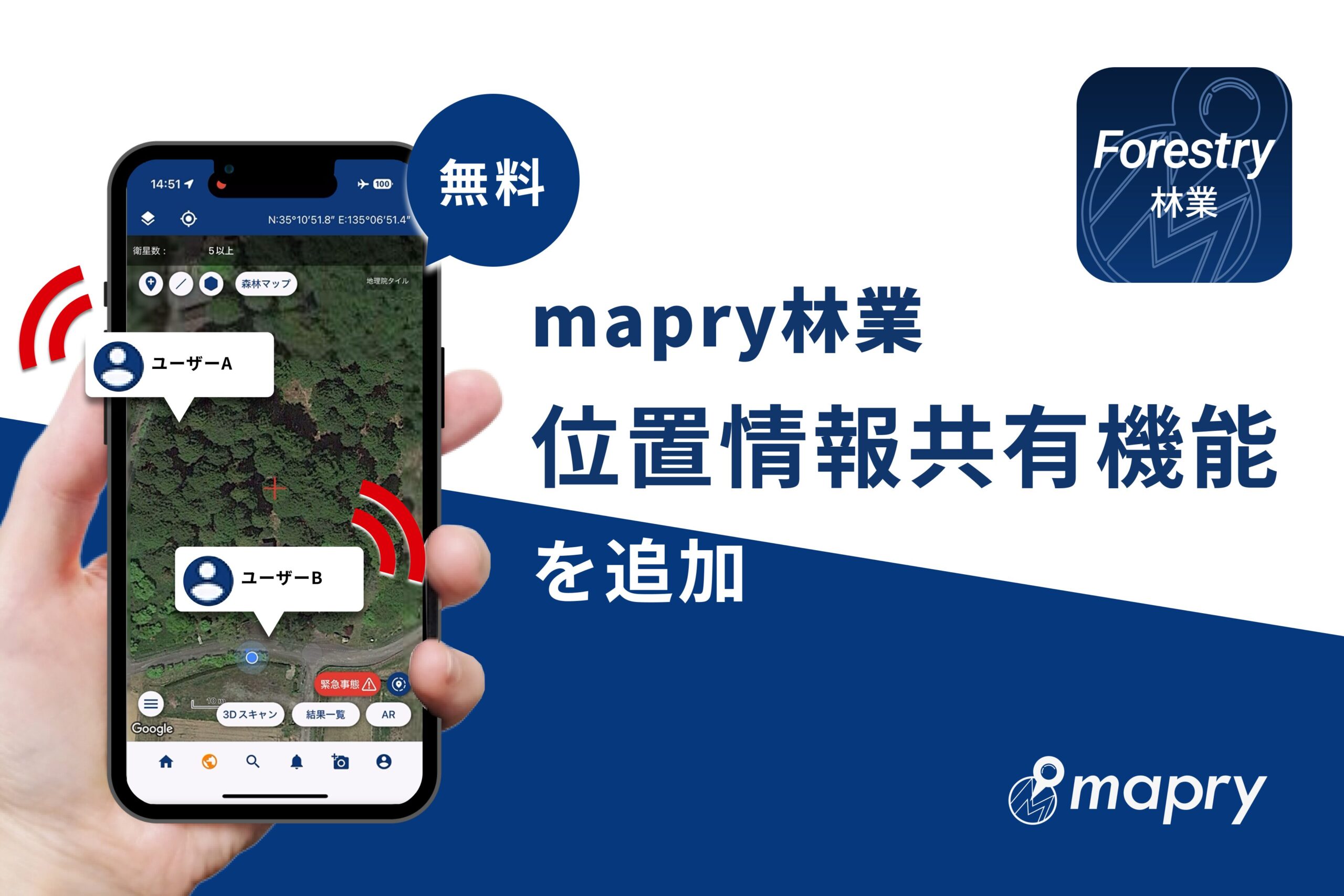
Adding location sharing function to mapry forestry, aiming to improve forestry safety
Mapry Inc. (Head office: Tamba City, Hyogo Prefecture, CEO: Keiji Yamaguchi, hereafter referred to as Mapry), which provides the geospatial information app platform service “mapry,” has added a location sharing function and an emergency notification function to the forestry/forest management application “mapry forestry.” The aim is to provide a service that many users can use easily and contribute to improving forestry safety.
■About mapry forestry
mapry forestry is an application specialized for forestry measurements that allows you to easily obtain highly accurate data on your iPhone or iPad. You can easily perform tree-by-tree surveys, as well as surveys of the completed shape and surroundings of work roads. It is a tool that can be used for forest management projects and is already being used by many forestry associations.
mapry forestry introduction page URL: https://mapry.co.jp/forestry/
●Main functions of mapry forestry
<Functions that anyone can use>
– Function to create marker points and polygons on the map
– Function to link photo and video data to the map as a digital field notebook
– GPS tracking
– Location information sharing, sending warnings, etc.
<Functions available with a paid version contract>
In addition to the above functions, you can use functions that use 3D scanning.
– Tree survey
– Installation/inspection of standard land
– Surrounding survey
– Work road measurement
– GNSS survey, etc.
[Paid version compatible models] iPhone 14 Pro and later (capacity 128GB and up), iPad Pro 2021 model and later (Wi-Fi + cellular model, capacity 128GB and up)
■ Update information
● Location information sharing
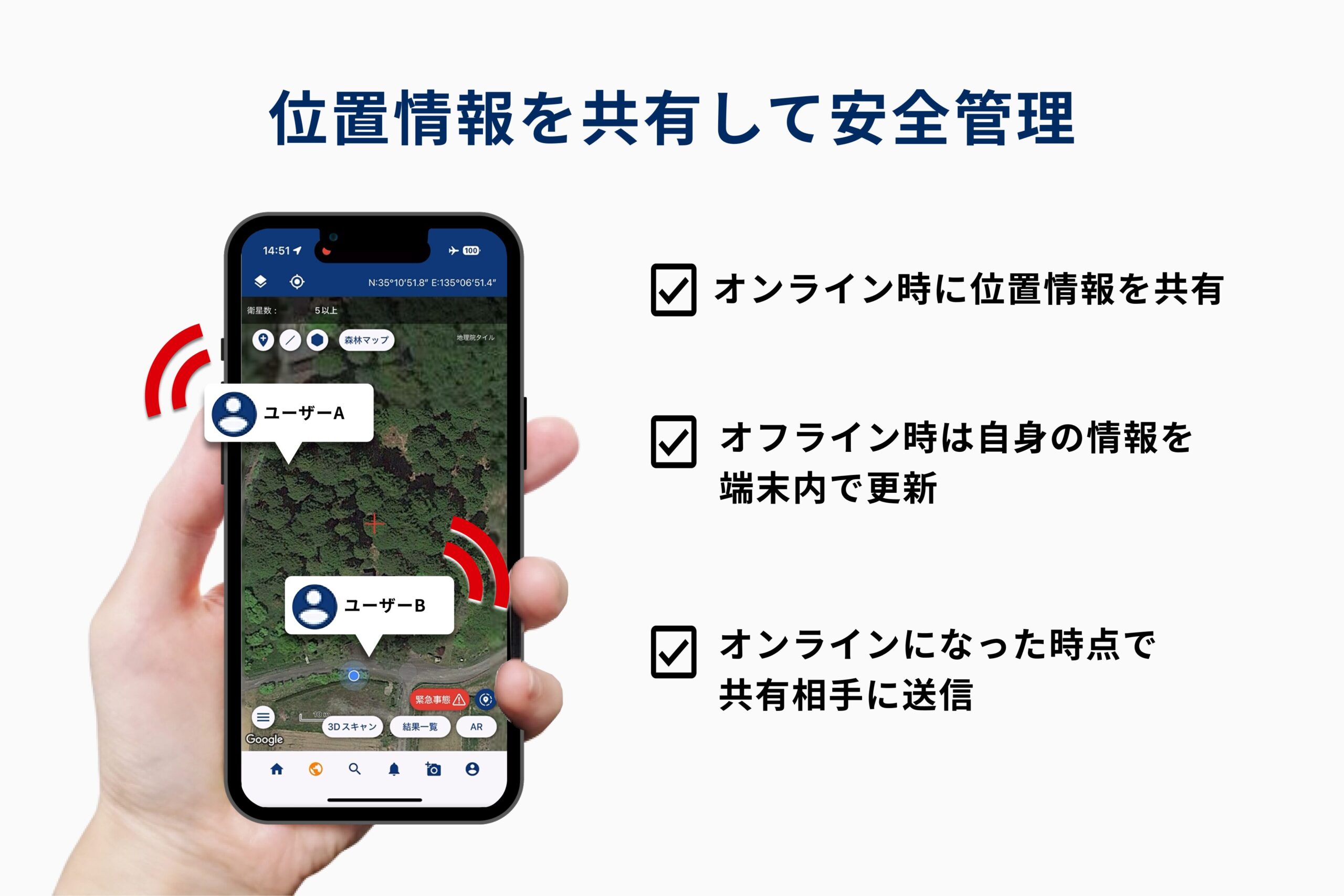
The location information sharing function is a function that shares the location information of the set user on the map. The location of the selected user is displayed with a marker on the map and shared in real time.
* When offline, your location information will continue to be updated on the device and will be sent to the sharing partner when it becomes online. In addition, the latest location information will be received from the other party when they go online at the same time.
●Warning
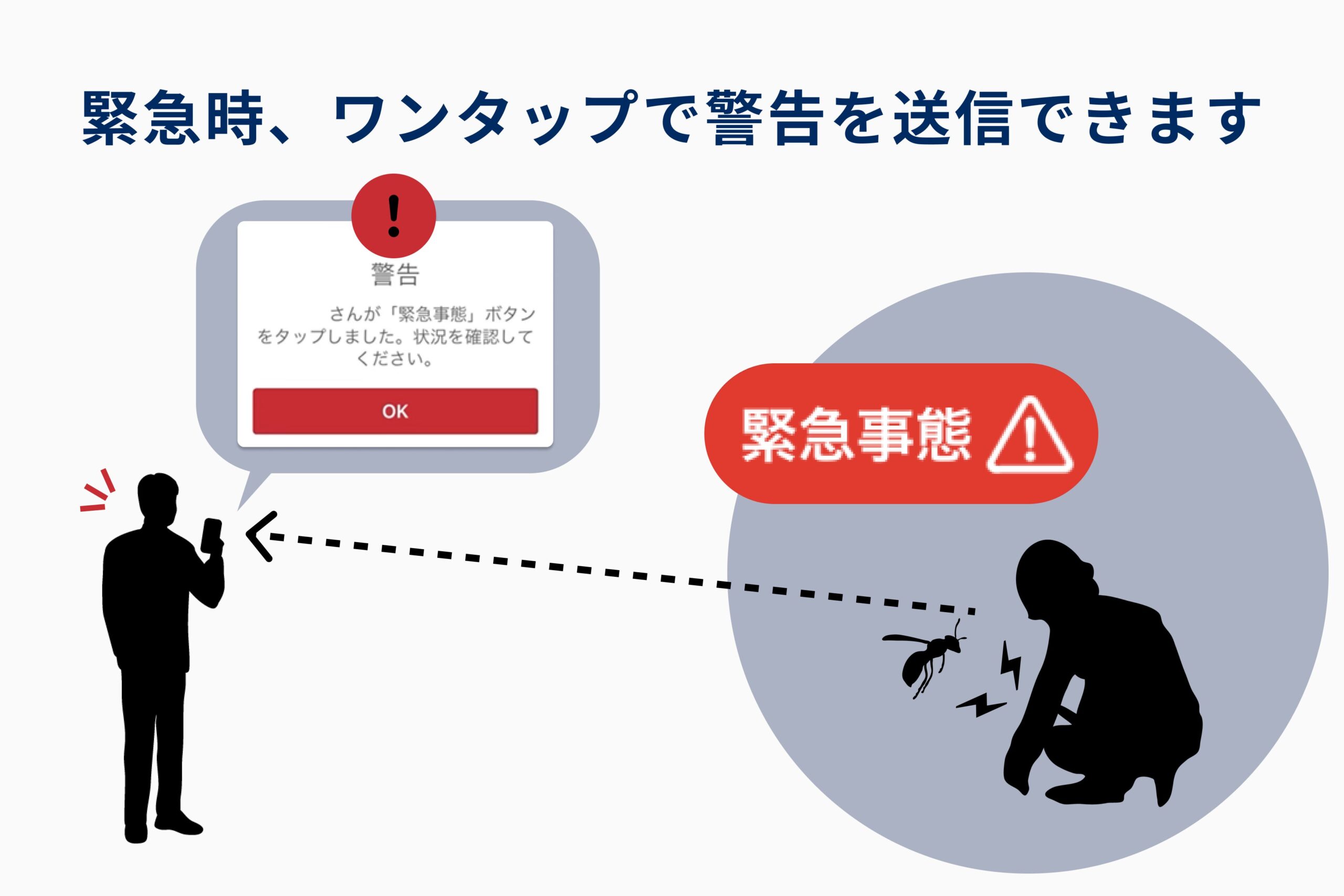
When a dangerous situation occurs, you can send a warning to the user you are sharing with.
A warning will be displayed to the other party under the following two conditions.
・When the emergency button is tapped
・When there has been no movement for more than 30 minutes
It can be used as a tool to ensure safety in the event of an accident, heat stroke, encounter with wild animals, etc., in forestry work sites where there are many risks.
■Usage fee
It is free to use. <Excluding 3D scanning>
■How to use
・App Store
https://apps.apple.com/jp/app/mapry%E6%9E%97%E6%A5%AD/id6443788745
mapry forestry introduction page URL: https://mapry.co.jp/forestry/
<Contact consultation desk for paid version>
info@mapry.co.jp
Please contact us with your company name, name, and phone number.
■About Mapry
Mapry is a service for anyone involved in surveying, forestry, disaster prevention, agriculture, and construction. We provide solutions that make it easy to acquire, analyze, and utilize 3D data, which has previously been difficult to do due to the cost of surveying equipment and the difficulty of operating and analyzing the equipment.
●Company Overview
Company Name: Mapry Co., Ltd.
Location: 165 Tada, Kasuga-cho, Tamba-shi, Hyogo Prefecture (Head Office)
Representative: CEO Keiji Yamaguchi
Website: https://mapry.co.jp
Inquiries regarding this matter: info@mapry.co.jp
“mapry Bridge” to streamline mandatory inspections of small bridges is now on sale. Basis Consulting, which promotes digital transformation in the infrastructure field, is participating as a sales partner.
Signed an agreement with Saiki Regional Forestry Association in Oita Prefecture to realize Forestry DX.