
PC version(Point cloud analysis)
mapry PC version dawnloadWindows
latest version
※A warning message will appear due to the size of the file to be downloaded, please continue with the download.
While the previous beta version included features such as topographic data creation, the official version includes the following improvements and additions.
・Point cloud analysis (lumber volume, topography, etc.) measured with long-range LiDAR
・Point cloud analysis (lumber volume, topography, etc.) measured by laser drone
・Acquisition and display of image linkage
・Ortho imaging
・UI modification, etc.
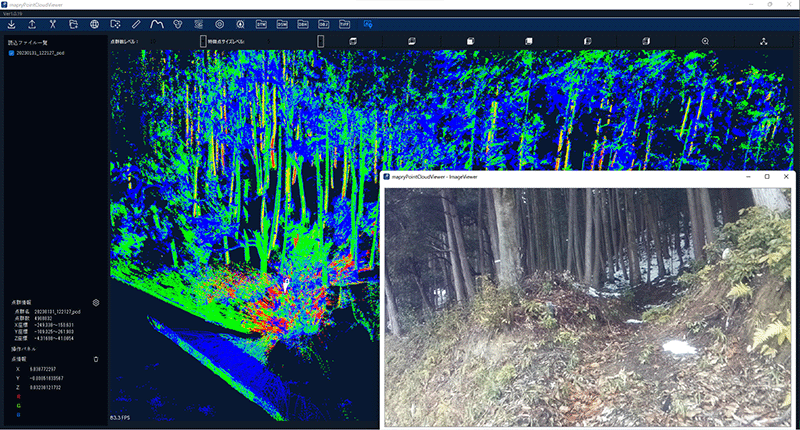
Point cloud and Image
Data and images acquired by LA03 can be checked.
The data measured by LA01 at fixed point can be output as a colored point cloud, and the length of line segments can be measured.
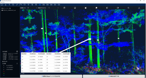
volume and weight
The point cloud data acquired by LA03 can be used to measure breast height diameter, tree height, and timber volume.
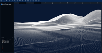
DTM、DSM
LA03, the ground surface (DTM) and surface layer (DSM) can be created from point clouds acquired with a laser drone.
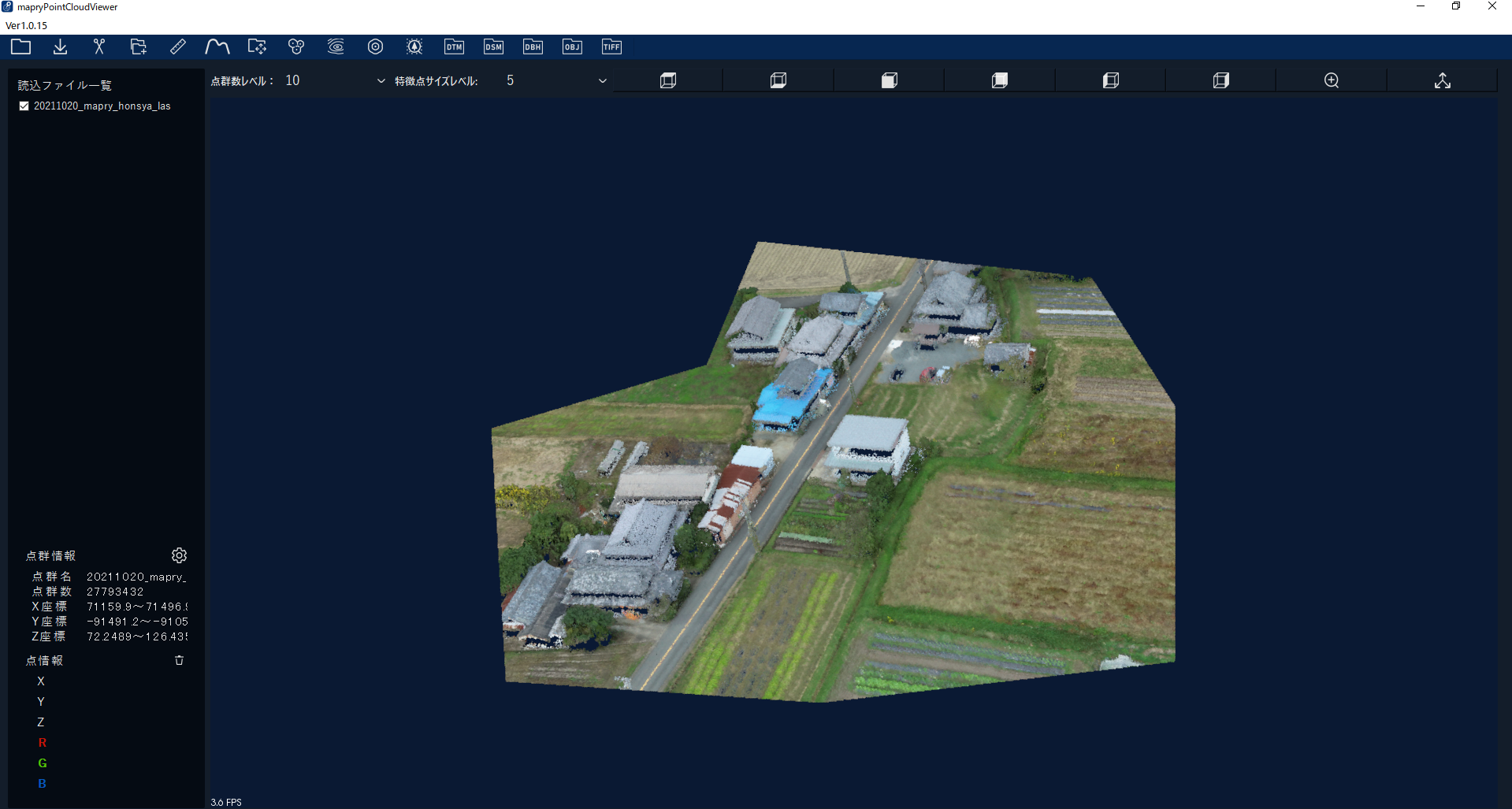
laser loan
It is possible to create colored point clouds and generate orthoimages.
Price
Free